EarthConsole® Stories: HYDROCOASTAL project enhancing the understanding of river discharge-coastal sea levels interactions
EarthConsole® Stories are experiences about how we helped universities, research centres or service developers to leverage earth observation data to extract valuable insights for their research, educational or pre-commercial projects.
The Project
With funding from the European Space Agency (ESA), the Hydrocoastal project aims at making the most of SAR and SARin altimeter measurements in coastal areas and inland waters. To accomplish this goal, the project seeks to explore and implement novel methodologies for processing SAR and SARin data obtained from CryoSat-2, as well as SAR altimeter data gathered from Sentinel-3A and Sentinel-3B satellites.
An important focus of the project is to enhance the comprehension of the relationship between river discharge and coastal sea levels. To facilitate this understanding, the research team developed, implemented, and assessed new SAR and SARIn processing algorithms. From the results of this evaluation a processing scheme has been implemented to generate global coastal zone and river discharge data sets. The potential impact and benefits of these datasets will then be investigated through a series of impact assessment case studies.
Furthermore, as part of promoting collaboration and knowledge sharing, all generated datasets will be made available upon request to external researchers, fostering further exploration and analysis in related fields.
The Need
The Hydrocoastal project has developed a delay-doppler processor in Python. This processor can take Sentinel-3 SRAL L1A and Cryosat-2 FBR data and turn it into L1B data in a customised netCDF format. These data products were additionally extended to include data from Sentinel-3 and Cryosat-2 L2 files.
In the earlier phase of the project, the team developed different retracking tools that could work with these products. These tools were tested and compared with the goal of selecting a single retracking solution. Only the selected tool was to be applied to the data products created by the Python delay-doppler processor.
At this point the research team needed a suitable solution to perform these processing steps and generate the global coastal zone and river discharge datasets and resorted to GBOX (Integrated Algorithm and Execution Environment) available via the ESA Altimetry Virtual Lab hosted on EarthConsole®.
Why EarthConsole®
The Team resorted to EarthConsole® G-BOX as it offered the necessary computing resources to efficiently deliver the global validated coastal zone datasets and river discharge datasets.
The initial phase of the project, involving the definition of products and assessment of various algorithms, has been successfully completed internally. For the next phase involving the generation of the datasets, we selected EarthConsole® G-BOX for its potential to significantly expedite our data processing timeline compared to our in-house facilities. By leveraging G-BOX, we eliminated the lengthy process of downloading input data. This enabled us to deliver the global datasets in a much shorter time, meeting our project goals effectively.
The project impact
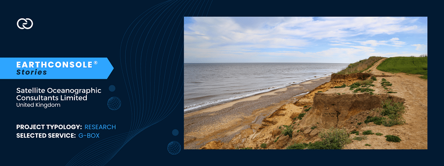
The ESA Hydrocoastal project has the ambition to utilize the global datasets to foster more effective management strategies for various coastal regions. These areas have common features such as flooding and erosion, sedimentation, the importance of accurate high resolution local modelling, the vulnerability of coastal habitats, the connection between river discharge and coastal sea levels.
Simultaneously, the project focuses on investigating the potential for operational hydrological forecasting in inland water systems, assessing the influence of lake size and riverbank configuration on water level retrieval accuracy, quantifying the freshwater inflow into the seas under examination, and developing a comprehensive global water level climatology.
This project has been supported via the ESA Network of Resources initiative.


")


