As we near the close of 2023, it is the perfect time to unwrap some of the highlights of this year, which has been nothing short of extraordinary for EarthConsole®.
We’ve been right there, sticking to our promise of helping the scientific community getting value added information from Earth Observation data.
Been at it for years, our dedication is still going strong today and will continue in 2024, bringing in new services and options for data processing.
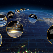
The ESA Heritage Missions Virtual Lab: Unleashing the Potential of Retired Earth Observation Missions
We have proudly introduced the ESA Heritage Missions Virtual Lab, a new space on EarthConsole® dedicated to harnessing the vast potential of data from non-operational Earth Observation missions.
Even though these missions have retired, their data remain a goldmine for understanding current natural phenomena.
It’s a true honour to take on this responsibility from ESA, and we’re excited to have kicked things off with the On-Demand Small Baseline Subset for ENVISAT service by IREA – CNR to study the temporal evolution of natural or human induced surface deformation.
Right now, it’s the first (and only, for the moment) service in this Lab.
But we’ve got more processors lined up, since renowned research institutions have already manifested their interest in sharing their Heritage Missions data-based algorithms with our users’ community.
These are high on our priority list for integration in 2024, so keep an eye out for those updates!
And here’s the best part—subscribing to the Lab won’t cost you a penny. Once ESA gives the green light, you’ll have a head start with 100 free processing hours.
And if you have an algorithm of your own, let us know via our web app for a chance to be considered for a free integration into the Lab.
EarthConsole® on the ESA Network of Resources: Empowering Earth Observation Research and Educational projects, also in 2024
In 2023, we assisted 20 research and educational projects that received financial support from the ESA Network of Resources, allowing their teams to utilise our services free of charge.
It’s truly gratifying to see so many of our users taking advantage of this opportunity thanks to the scientific merit of their projects.
Looking ahead to 2024, we plan to add new services to the EarthConsole® offering such as the SBAS for Sentinel-1 on demand service based on the algorithm owned by IREA – CNR. We plan to make it available in the first quarter of next year.
And we’re also excited to share that the ESA Network of Resources will continue to offer sponsorship opportunities for research, educational, and pre-commercial projects.
To get your sponsorship request process started, first connect with us through our web app to ask for the desired services. You will find us on the other side, ready to guide you through the entire process, ensuring you get the financial and technical support you need.
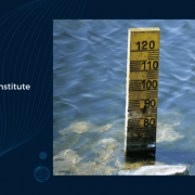
ESA Altimetry Virtual Lab: A Growing Community of Altimetry Data Users
The ESA Altimetry Virtual Lab on EarthConsole® continues to thrive, with over 100 members and a repository of processed data exceeding 10 TB.
This year alone, the lab’s services contributed to the publication of 5 scientific papers, adding to the 40+ publications accessible via the open ESA Altimetry Virtual Lab library.
Joining this very active community is free and easy!
And for more details on the Lab’s altimetry SAR services and a glimpse into what lies ahead, you can check out the abstract from the recent poster session held at the AGU Annual Meeting in San Francisco.
OCRE-Funded Projects: Earth Observation Services for Extensive Processing Campaigns
We have proudly served as a service provider for two research projects funded through the OCRE (Open Clouds for Research Environments) initiative. These projects involved extensive data processing using the Altimetry Virtual Lab’s ESA-ESRIN SARvatore services for CryoSat-2 and Sentinel-3 missions.
The CENTEC-led project, focusing on renewable wave energy in the Atlantic Ocean, has recently concluded, and its outcomes are generously shared through the Altimetry Virtual Lab datasets repository.
At the same time, the ongoing project led by the Technical University of Denmark aims to produce an open-access dataset derived from past and future CryoSat-2 altimetry mission acquisitions over the polar ice caps. This ambitious goal here is to turn this dataset into the go-to reference standard for the radar altimetry research community studying polar oceans.
Get ready to welcome WIMEX into the EarthConsole® suite of services widening support for the scientific community
WIMEX (Wave Interaction Models EXploitation) is ready to step into the scene next year. This ESA initiative led by Sapienza University of Rome and contributed by us at Progressive Systems as a partner, proposes a brand-new framework designed to make your life easier by letting you develop, validate and use your forward and inverse electromagnetic wave interaction models through a systematic approach.
The WIMEX prototype is gearing up to make its debut, starting with a focus on forward and inverse models for soil moisture and snow water equivalent, in the second half of 2024.
At the moment we’re on the lookout for Earth Observation innovators like you to join the beta testing crew. If you want to be part of the action and help refine the prototype once it’s ready to roll, let us know.
As we wrap up this remarkable year, we’re already gearing up for an even more Earth Observation data-rich and service-packed 2024 in the world of Earth Sciences!
Thank you for your trust and continued support, which made it all possible.
In the meantime, it’s time to rest and wish you and your loved ones a joyous and Merry Christmas, filled with warmth and happiness.

 Satellite images © ESA