USER MANUAL
SBAS for ENVISAT (beta)
Owner: IREA CNR
This is a short user manual for the SBAS-InSAR chain developed on the EarthConsole® P-PRO ON DEMAND infrastructure to help the users to properly exploit the service.
This manual is addressed to users already familiar with InSAR processing, analysis and products.
You can download the user manual also in PDF format.
Differential Synthetic Aperture Radar Interferometry (InSAR) is a technique for generating displacement maps of single events by calculating the phase difference (interferogram) of two SAR images acquired over the same area and from temporally separated acquisition orbits. By exploiting a large number of differential interferograms, several Advanced InSAR techniques have been developed, allowing to follow the temporal evolution of the ground displacements. From now on we particularly address the Advanced InSAR technique referred to as Small BAseline Subset (SBAS) algorithm [1].
Following up the collaboration between CNR-IREA [2] and ESA-RSS [3] in the framework of the ESA’s Grid Processing, the Parallel-SBAS (P-SBAS) [4] algorithm, which takes benefit from High Performance Computing resources, has been integrated within the EarthConsole® P-PRO On Demand [5] environment to provide users with a service for the generation of Earth’s surface deformation time series and, more generally, interferometric products, in unsupervised way. The P-PRO ON DEMAND flexibility and an user-friendly interface allows users to perform a SBAS-InSAR processing in a reasonable time. The aim of this activity is to provide the Earth Observation community with an automatic tool for improving the surface deformation analyses and thus making advances in understanding several geophysical phenomena.
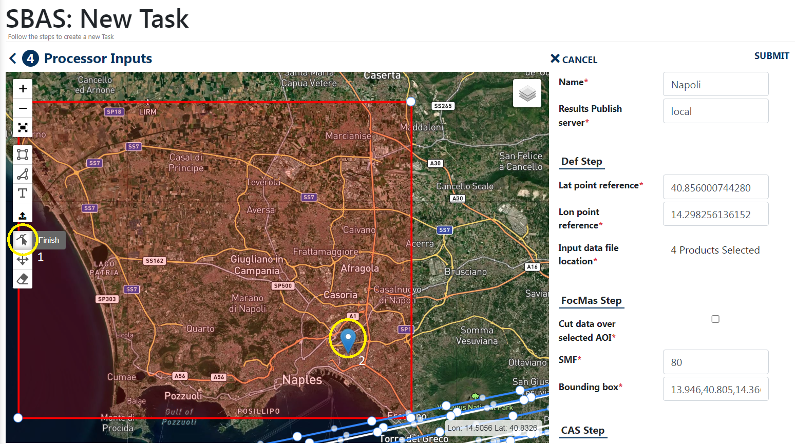
The main user actions are the following:
- select the SAR data to be processed through a defined computing element;
- set input parameters/threshold (e.g. baseline, temporal coherence, …) for SBAS-InSAR processing;
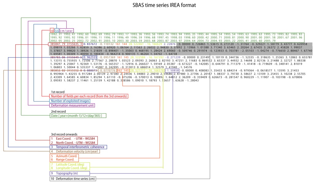
- obtain SBAS-InSAR geocoded (Lat/Lon and/or UTM WGS84) results, such as mean deformation velocity map and deformation time series.
The provided service performs the full SBAS InSAR chain from RAW data (Level 0) focusing to displacement time series generation. As additional feature, the possibility to generate single interferograms is also available.
The service provides in output SBAS-InSAR geocoded (Lat/Lon and/or UTM WGS84) results, such as mean deformation velocity map and deformation time series.