Image of sea near the coastline

Coastal and Open Ocean Altimetry Data: How ALES unlocks insights from 1995 to today on EarthConsole®

In the world of satellite altimetry, precision is key. For years, satellites have revolutionized how we measure sea levels, monitor ocean currents, and track environmental changes.

But there’s been one tricky area for researchers: coastal regions.

Historically, satellite altimeters have struggled to provide reliable data near coastlines.

That’s where ALES — the Adaptive Leading Edge Subwaveform retracker — available on EarthConsole® comes in, offering a new way to make accurate altimetry measurements.

What is ALES and why should you care?

ALES is a subwaveform retracking algorithm developed by Marcello Passaro from the German Geodetic Research Institute of the Technical University of Munich, to overcome the challenges altimeters face when measuring sea levels close to the coast.

ALES improves the accuracy of satellite data near coastlines, all while maintaining high accuracy in open ocean measurements, making it a relevant tool for scientists, oceanographers, and anyone tracking sea level rise or coastal changes.

How Does ALES Work?

To understand how ALES functions, let’s start with how satellite radar altimetry works.

Satellites send out radar signals that bounce off earth surface and catch the echoes as they bounce back. The time it takes for these signals to return helps calculate the distance to the surface, allowing us to determine for example sea level. While this process is straightforward in open waters, it becomes complicated near the coast due to interference from land or other reflective objects like for example ship traffic.

ALES works by looking at the signals the satellite gets back and focusing on a specific part of each signal – the leading edge. From this section, ALES makes a rough estimate of how tall the waves are. This information is important because knowing the wave height helps improve the accuracy of the data.

Once ALES has the wave height estimate, it can choose the best part of the wave signal to analyze. By narrowing its focus, ALES can avoid interference from other factors, such as reflections from land or ships. This targeted analysis helps to eliminate noise and enhances the quality of the data, resulting in more precise measurements of sea level.

ALES on EarthConsole®

You can now access an extensive time series of altimetry data spanning from 1995 to today, thanks to the addition of the bulk processing option for ALES for Envisat and ERS-2 data (both missions no longer operational in space) via the Heritage Missions Virtual Lab on EarthConsole®.

This addition complements the existing ALES+ SAR service for Sentinel-3 and CryoSat-2, which was already available for both bulk and on-demand processing via the Altimetry Virtual Lab on EarthConsole®.

This will provide you with a clearer understanding of how coastal zones and open ocean conditions have evolved over the last three decades.

Getting started with ALES for ENVISAT or ALES for ERS-2 (FREE ACCESS):

  1. Log in to www.earthconsole.eu.
  2. Request a free membership to the Heritage Missions Virtual Lab www.earthconsole.eu/groups/heritage-missions.
  3. Click on the card ‘Request the service you need’ and submit the service request using the dedicated form within the Lab.
  4. Wait for approval; it may take a few days as we process your request with ESA.
  5. Once approved, you’ll receive 100 free processing hours, which can be renewed for another 100 hours pending ESA approval.

What makes ALES stand out is its adaptability and versatility.

Whether it’s applied to older satellite missions like ERS-2 and Envisat, or the latest missions like CryoSat-2 and Sentinel-3, ALES is applicable to waveforms from different altimeters. This flexibility enables to extend the time series and ensures that we can analyze both historical and current satellite data to better understand sea level changes over time.

If you’re interested in finding out whether ALES is suitable for your research, feel free to contact us at info@earthconsole.eu.

Image of a river flowing

EarthConsole® Stories: Tracking and predicting changes in river systems with ENVISAT data

EarthConsole® Stories are experiences about how we helped universities, research centres or service developers to leverage Earth Observation data to extract valuable insights for their research, educational or pre-commercial projects.

The Project

The ESA River Discharge Climate Change Initiative aims to generate long-term climate data records—spanning at least 20 years—of river discharge for selected river basins and key locations within their networks. This will be achieved using satellite remote sensing observations, including altimetry and multispectral images, along with ancillary data. This data is essential for understanding the flow and behaviour of rivers in specific regions and at critical points along their courses. The goal is to develop a robust analytical tool capable of tracking and predicting changes in river systems resulting from climate change.

The Need

The research team, tasked with managing ENVISAT MERIS data spanning 2002 to 2012 from multiple global sites, required an efficient platform for handling this extensive dataset. They found the ideal solution in the Heritage Missions Virtual Lab, an ESA initiative hosted on EarthConsole®. This platform provides specialized processing services for data from discontinued Earth Observation missions like ENVISAT.

Beyond data access, the team needed to generate Analysis Ready Data (ARD) for the MERIS FR datasets. For this purpose, the EarthConsole® team developed a tool that automatically extracted time series data from approximately 25,000 MERIS FR Level 2 products, targeting specific stations within 45 worldwide sites. This process produced around 72,000 subsets, which were subsequently utilized in the neural network model developed by the team.

Why EarthConsole®

The EarthConsole® G-BOX hosting service via the Heritage Missions Virtual Lab was the research team’s choice for direct access to ENVISAT Meris data.

The service was used to process Analysis Ready Data for large ENVISAT MERIS FR datasets for 45 sites worldwide with our own neural network model. In fact, the processing of the huge number of images from 2002 to 2012 would have been too time consuming to be handled on our local infrastructure. The EarthConsole® hosting service was used to speed up the process and provide a consistent and practical method to process the multi-temporal analyses to be later on compared with the in-situ river discharge

Paolo Filippucci, Researcher at IRPI CNR – Italy


The Impact

The ESA River Discharge Climate Change Initiative will greatly benefit the research community and society by using advanced satellite technology to monitor and analyse river ecosystems over time. This project provides crucial data on river flow and behaviour, helping to track and predict changes due to climate change. Researchers, environmentalists, and policymakers will gain valuable insights, enabling better decision-making for sustainable water management and climate resilience.

This project has been supported via the ESA Network of Resources initiative.


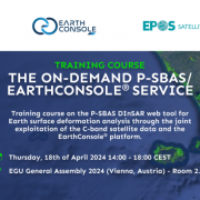
EGU 2024: training course on the P-SBAS DInSAR web tool for Earth surface deformation

Earth surface deformation due to phenomena like volcanic eruptions, earthquakes, landslides, land subsidence due to fluid extraction activities or large infrastructure construction, can be effectively investigated using Synthetic Aperture Radar (SAR) sensors.

Through the SAR Interferometry (InSAR) technique, two radar images of the Earth’s surface are captured from slightly different angles. By comparing these images, detailed three-dimensional maps of the ground can be created, providing valuable insights into its topography.

When these images are taken at different times, employing the Differential SAR Interferometry (DInSAR) technique, it becomes possible to measure changes in the Earth’s surface over time.

One particularly effective method for tracking these changes is the Parallel Small BAseline Subset (P-SBAS) algorithm, developed at IREA-CNR.

During the EGU General Assembly 2024, on April 18th, IREA – CNR will be conducting a training course, organized with our support, on the P-SBAS DInSAR on-demand service integrated on the EarthConsole® platform.

In this training, you will be guided by IREA – CNR team experts on the Interferometric analysis and on the use of this tool to process both Sentinel-1 and ENVISAT SAR images in a fully unsupervised manner, all through the EarthConsole® P-PRO ON DEMAND web interface without the need to download data to your own processing and archiving systems.

You will also be introduced to the ESA Network of Resources (NoR) initiative that may sponsor scientific users to access the P-SBAS DInSAR on EarthConsole® free of charge.

Find more information on the course either online or on this flyer.

The entry into operation of the P-SBAS DInSAR for Sentinel-1 on-demand service represents an important opportunity for researchers studying Earth surface deformation as it complements the already operational P-SBAS DInSAR for ENVISAT on-demand service available through the ESA Heritage Missions Virtual Lab hosted on EarthConsole®.

This will enable researchers to generate time series and get insights into the evolution of Earth surface deformation over the years.

 How to access these services on EarthConsole®:

  • Log in/Register on the EarthConsole® webapp.
  • For P-SBAS DInSAR for Sentinel-1: fill in the P-PRO ON DEMAND form. We will use the information collected through the form to prepare a sponsorship request for the ESA Network of Resources initiative, that we will send you for your review and approval. If authorized by ESA, the NoR sponsorship would cover the cost of using the P-SBAS DInSAR for Sentinel-1 service within a 6-months time frame.
  • For P-SBAS DInSAR for ENVISAT: request a free of charge membership to the ESA Heritage Missions Virtual Lab. Upon authorization from ESA, you will receive 100 processing hours to start using the service.

If you need any clarification, please do not hesitate to get in touch at info@earthconsole.eu.


Banner with text saying EarthConsole 2023 wrapped.

EarthConsole® 2023 Wrapped: A Year in Review and Exciting Updates for 2024

As we near the close of 2023, it is the perfect time to unwrap some of the highlights of this year, which has been nothing short of extraordinary for EarthConsole®.

We’ve been right there, sticking to our promise of helping the scientific community getting value added information from Earth Observation data.

Been at it for years, our dedication is still going strong today and will continue in 2024, bringing in new services and options for data processing.

The ESA Heritage Missions Virtual Lab: Unleashing the Potential of Retired Earth Observation Missions

We have proudly introduced the ESA Heritage Missions Virtual Lab, a new space on EarthConsole® dedicated to harnessing the vast potential of data from non-operational Earth Observation missions.

Even though these missions have retired, their data remain a goldmine for understanding current natural phenomena.

It’s a true honour to take on this responsibility from ESA, and we’re excited to have kicked things off with the On-Demand Small Baseline Subset for ENVISAT service by IREA – CNR to study the temporal evolution of natural or human induced surface deformation.

Right now, it’s the first (and only, for the moment) service in this Lab.

But we’ve got more processors lined up, since renowned research institutions have already manifested their interest in sharing their Heritage Missions data-based algorithms with our users’ community.

These are high on our priority list for integration in 2024, so keep an eye out for those updates!

And here’s the best part—subscribing to the Lab won’t cost you a penny. Once ESA gives the green light, you’ll have a head start with 100 free processing hours.

And if you have an algorithm of your own, let us know via our web app for a chance to be considered for a free integration into the Lab.

EarthConsole® on the ESA Network of Resources: Empowering Earth Observation Research and Educational projects, also in 2024

In 2023, we assisted 20 research and educational projects that received financial support from the ESA Network of Resources, allowing their teams to utilise our services free of charge.

It’s truly gratifying to see so many of our users taking advantage of this opportunity thanks to the scientific merit of their projects.

Looking ahead to 2024, we plan to add new services to the EarthConsole® offering such as the SBAS for Sentinel-1 on demand service based on the algorithm owned by IREA – CNR. We plan to make it available in the first quarter of next year.

And we’re also excited to share that the ESA Network of Resources will continue to offer sponsorship opportunities for research, educational, and pre-commercial projects.

To get your sponsorship request process started, first connect with us through our web app to ask for the desired services. You will find us on the other side, ready to guide you through the entire process, ensuring you get the financial and technical support you need.

ESA Altimetry Virtual Lab: A Growing Community of Altimetry Data Users

The ESA Altimetry Virtual Lab on EarthConsole® continues to thrive, with over 100 members and a repository of processed data exceeding 10 TB.

This year alone, the lab’s services contributed to the publication of 5 scientific papers, adding to the 40+ publications accessible via the open ESA Altimetry Virtual Lab library.

Joining this very active community is free and easy!

And for more details on the Lab’s altimetry SAR services and a glimpse into what lies ahead, you can check out the abstract from the recent poster session held at the AGU Annual Meeting in San Francisco.

OCRE-Funded Projects: Earth Observation Services for Extensive Processing Campaigns

We have proudly served as a service provider for two research projects funded through the OCRE (Open Clouds for Research Environments) initiative. These projects involved extensive data processing using the Altimetry Virtual Lab’s ESA-ESRIN SARvatore services for CryoSat-2 and Sentinel-3 missions.

The CENTEC-led project, focusing on renewable wave energy in the Atlantic Ocean, has recently concluded, and its outcomes are generously shared through the Altimetry Virtual Lab datasets repository.

At the same time, the ongoing project led by the Technical University of Denmark aims to produce an open-access dataset derived from past and future CryoSat-2 altimetry mission acquisitions over the polar ice caps. This ambitious goal here is to turn this dataset into the go-to reference standard for the radar altimetry research community studying polar oceans.

Get ready to welcome WIMEX into the EarthConsole® suite of services widening support for the scientific community

WIMEX (Wave Interaction Models EXploitation) is ready to step into the scene next year. This ESA initiative led by Sapienza University of Rome and contributed by us at Progressive Systems as a partner, proposes a brand-new framework designed to make your life easier by letting you develop, validate and use your forward and inverse electromagnetic wave interaction models through a systematic approach.

The WIMEX prototype is gearing up to make its debut, starting with a focus on forward and inverse models for soil moisture and snow water equivalent, in the second half of 2024.

At the moment we’re on the lookout for Earth Observation innovators like you to join the beta testing crew. If you want to be part of the action and help refine the prototype once it’s ready to roll, let us know.

As we wrap up this remarkable year, we’re already gearing up for an even more Earth Observation data-rich and service-packed 2024 in the world of Earth Sciences!

Thank you for your trust and continued support, which made it all possible.

In the meantime, it’s time to rest and wish you and your loved ones a joyous and Merry Christmas, filled with warmth and happiness.

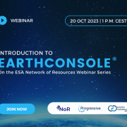
Banner showing the title and date of the webinar (20 October 2023)

Join the webinar on EarthConsole® organized by the ESA Network of Resources

If you are wondering where to start with EarthConsole® or how to broaden your usage of the platform, we are here to help.

Join us at this EarthConsole® webinar on October 20th at 1:00 p.m. CEST, part of the ESA Network of Resources (NoR) Webinar Series.

You can expect to:

  1. Gain insights on EarthConsole® services to:
    • develop, validate and run your algorithms
    • integrate your algorithm into a scalable environment
    • perform processing campaigns on large datasets
    • run integrated applications on your own
  2. Learn from real use cases.
  3. Get a walkthrough the ESA Virtual Labs hosted on EarthConsole®, designed for specific Earth Observation communities like Altimetry and Heritage Missions data users.
  4. Explore how to get your project sponsored by the ESA NoR.

No matter your background or level of Earth Observation expertise, the presentation has been designed with everybody in mind.

Don’t forget, this webinar is free. We hope to see you there!

Join the webinar on EarthConsole® organized by the ESA Network of Resources

Are you interested in EarthConsole® and exploring the opportunities offered by the ESA Network of Resources (NoR) initiative?

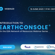
We are pleased to invite you to an informative webinar session on EarthConsole® next Friday June, 16 at 1 p.m. CEST organized by the ESA NoR initiative. In this webinar, you will:

  • gain a comprehensive overview of the EarthConsole® platform offer with a specific focus on its services:
    – G-BOX: Integrated Development and Execution Environment
    – I-APP: Application Integration Service
    – P-PRO and P-PRO ON DEMAND: Parallel Processing Service
  • explore the features, potential applications and real-world use cases of each service;
  • learn how to take advantage of the EarthConsole® Virtual Labs, the EarthConsole® virtual spaces tailored on the needs of specific Earth Observation communities. These spaces provide access to customized processing services and tools to facilitate collaboration and knowledge sharing.

Who can benefit from this webinar?

If you’re already familiar with EarthConsole® but still uncertain about how you can leverage the ESA Network of EO Resources, this webinar is for you.

If you’re new to EarthConsole® and eager to learn more, this webinar is for you too.

Whether you are a researcher, a professional in the industry or education field, a student working with earth observation data or just a non-practitioner with a passion for learning about Earth Observation (EO) cloud platforms, the webinar is open to all.

No matter your background, we encourage you to join us for this webinar.

How to register

Reserve your spot today by registering here.

We hope to see many of you there!

Invitation to integrate your processor for free on the ESA Heritage Missions Virtual Lab

Following the launch of the ESA/ESRIN Heritage Missions Virtual Lab hosted on the EarthConsole® platform last week, we would like to invite you to submit proposals for innovative algorithms and techniques to process Heritage Missions data to be made available as on-demand processing services via the lab.

If your processor will be selected by ESA/ESRIN, it will provide other interested researchers with the opportunity to analyze and review the data processed by your processor for their own research goals, in a joint effort to advance together in the study of environmental phenomena impacting our planet.

Once selected the processors, EarthConsole® team of experts will manage and supervise the integration process from start to finish. You will only have to focus on validating processing results.

Proposing your processor is easy – simply join the Heritage Missions Virtual Lab and use the dedicated I-APP form to submit your proposal.

The deadline for submissions is the 16th of June 2023.

For any further information, please have a look at this invitation.

If you have any further questions, please do not hesitate to contact us at info@earthconsole.eu with support@earthconsole.eu in cc.


Banner: satellites images © ESA
Heritage Missions orbiting the Earth

Introducing the ESA Heritage Missions Virtual Lab on EarthConsole®

We are excited to announce the launch of the ESA Heritage Missions Virtual Lab hosted on the EarthConsole® platform powered by Progressive Systems. This virtual space offers customized data processing services to harness the inestimable legacy left by the Heritage Missions, all accessible via single sign-on.

If you are not familiar with Heritage Missions, they consist of over 45 non-operational earth observation missions, including cornerstone ESA missions such as the European Remote Sensing satellites, ERS-1 and ERS-2, and ENVISAT. These missions acquired data from various optical, radar, and atmospheric instruments for over 40 years.

As you can imagine, the preservation of data coming from these missions is of key importance for the ongoing environmental research on our planet. When combined with data from new satellites, Heritage Missions data provides a unique opportunity to look back in time and build long-term data series on a diverse range of applications such as climate change, sea levels, surface temperatures, melting ice, earthquakes and volcanic eruptions, atmospheric composition, deforestation, urban mapping and much more.

That’s why we have collaborated with ESA to create this Lab which offers research centers and universities the chance to gain a deeper understanding of the evolution of Earth dynamics over time, by leveraging Heritage Missions data and related processors.

We have made sure to maintain the unique features of EarthConsole® intact, that means ensuring the processing capacity and data are co-located. This reduces the time taken for data transfer and enables completion of scalable processing campaigns within the stipulated time frame of research projects.

The Lab lets you:

  • Perform bulk processing campaigns (supervised by EarthConsole® experts) or on demand processing tasks (unsupervised and independently managed by the user) with the Small BAseline Subset – SBAS processor provided by IREA, a scientific and technological research institute belonging to the largest Italian research institution, the National Research Council (CNR). The service provides the possibility to generate soil deformation maps and time series from ERS and ENVISAT data. Additional processors will be integrated in the future.
  • Develop, test algorithms and do post-processing activities on a ready-to-use virtual machine with instant cloud data access, software for Heritage data analysis & visualization already installed and flexible computing resources and storage.
  • Receive expert support to integrate, in principle, any additional processors.
  • Access a set of tools to network and share research results with colleagues: a forum, a repository of processed datasets, and a library with relevant publications and media for consultation.

If you plan to use the lab services for research, educational, or pre-commercial purposes, you may be eligible to submit a sponsorship request to the ESA Network of Resources. If your application will be successful, it would allow you to receive a voucher that may fully cover the costs of the services.

Join the ESA Heritage Missions Virtual Lab today and take advantage of this exceptional opportunity.

To register, simply follow the provided instructions and forms to request the service. And if you have any questions, don’t hesitate to contact us at info@earthconsole.eu with support@earthconsole.eu in cc.

Stay tuned for updates and the upcoming not-to-be-missed invitation to propose your processor to be integrated into the Lab!


This is a project supported by the ESA Network of Resources initiative.