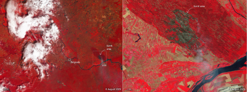
 CREDIT: contains modified Copernicus Sentinel data (2026), processed by ESA.
How Europe’s fire data got three times faster, without a single new satellite
This summer, while large areas of countryside in many European countries dealt with wildfires, something changed in the way satellite data reaches the people who respond to them. This change is worth a closer look, because it says a lot about where the value of data may also come from.
What happened
The Sentinel-3 satellite, part of Europe’s Copernicus programme, keep constant watch over land, oceans and atmosphere. Among the many things its instruments can pick up are active fires.
Until recently, its data reached users within three hours of being captured. This acquisition time is perfectly adequate for most of its observation purposes. For a fire moving through dry countryside in August, it is not. Three hours can separate a contained incident from a much larger one.
So, the teams at ESA and Eumetsat, who operate the mission together, went looking for a way to speed things up. In August they announced the result: images taken over central and southern Europe now arrive in 60 to 90 minutes. Up to three times faster than before, this change has been in regular use in orbit since the beginning of August.
The timing was no accident. Between the first of May and mid-August, the rapid mapping service of the Copernicus Emergency Management Service had been activated 41 times for wildfires in Europe (as of 17 August). When a fire broke out east of Belgrade, in Serbia, the new approach delivered data over the area within about an hour.
What did not change
Here is the part we find most interesting: nothing changed in space.
No new satellite was launched. No instrument was upgraded. The measurements are exactly the ones the mission was already taking. What changed is the delivery. Simplifying a little: Sentinel-3 gathers data as it orbits and sends it down in one go when it passes within reach of the Svalbard ground station, in Norway, with the oldest data transmitted first.
Under the old routine, there was a cut-off: everything captured after the satellite came into view of the antenna, roughly as it flew over northern Germany, had to wait for the next pass. Which meant that the freshest images of Europe, taken on the way north, were exactly the ones arriving last.
The teams reworked this routine so that the satellite now does two things at once while the antenna is in sight: it keeps downloading the data from its completed orbit, and at the same time it transmits what it is capturing at that very moment. The newest data over Europe no longer waits its turn.
For someone coordinating a response on the ground, this procedural change makes the whole difference. A fire map that arrives within the hour is a great support for decisions.
The lesson travels well beyond fires
It is tempting to think that the value of data only lives in the instrument: the satellite, the sensor, what it can measure and how precisely. This story suggests something different. A good part of the value lives in the route between the measurement and the person who has to act on it. Improve the route, and the same data is suddenly worth more. In this case, three times more.
Emergency response makes this visible, because there the useful window is measured in minutes and hours. But every field has a window of its own: a span of time within which information can still change a decision, and after which it can only describe what happened. A farm deciding when and where to irrigate has days. A city planning where to add green areas has a budget cycle. An authority tracking coastal change has a season. The scale changes, the logic does not: in every case, the question is not only what the data shows, but whether it reaches the right desk while the decision is still open. A fire map that arrives within the hour can still shape a decision. The same map, three hours later, mostly records one that has already been made.
This article is part of EOReach, an initiative by Progressive Systems to bring Earth Observation data, tools and knowledge into any application domain. If you are interested in exploring how EO data can support your domain, you can contact us at info@earthconsole.eu.
Image credit: contains modified Copernicus Sentinel data (2026), processed by ESA.